How Thunderstorms Form and Lightning Strikes
Vigorous updrafts, ice crystal collisions and powerful electrical channels turn turbulent atmospheric moisture into nature's most intense discharges.
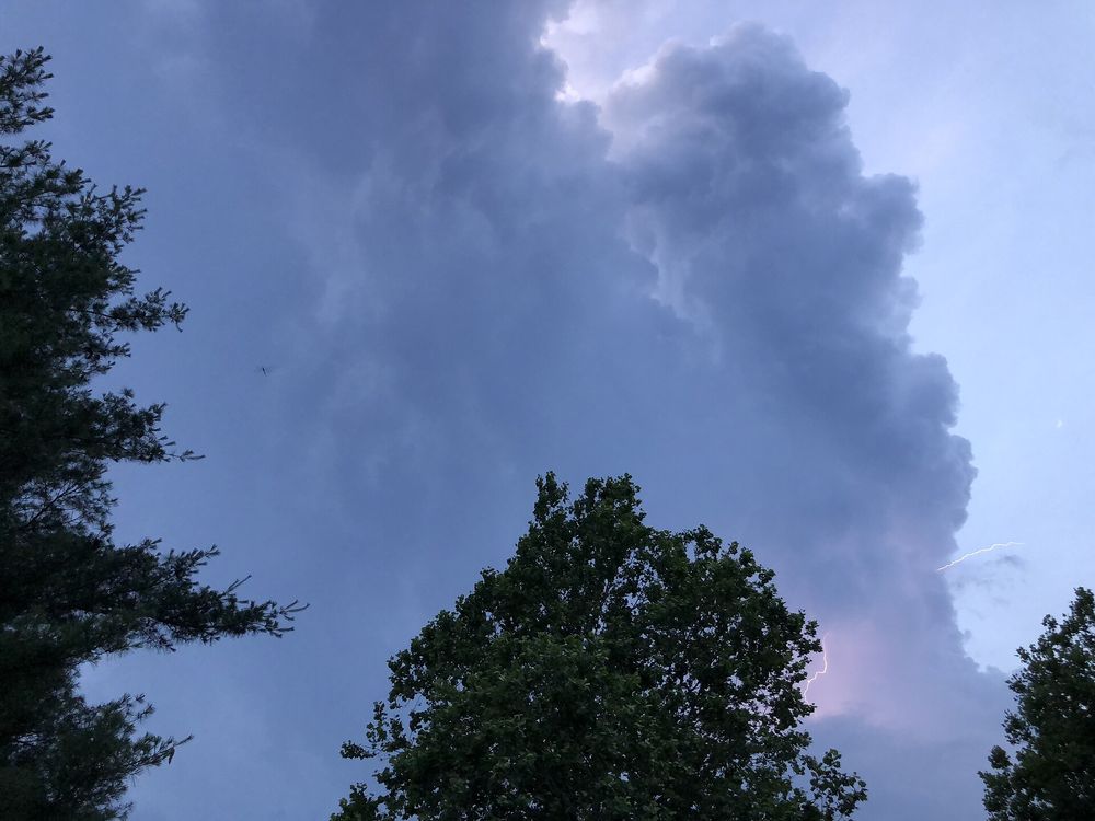
Every thunderstorm begins with an unstable atmosphere and rising air, growing from buoyant pockets of moisture into towering columns that produce dramatic electrical discharges. According to Wikipedia’s overview of thunderstorms, the basic ingredients required for their formation are atmospheric moisture, an unstable air mass, and a lifting mechanism such as solar ground heating, converging winds, or mountainous terrain [1]. When warm, moist air is forced upward, it cools and its water vapour condenses to form towering cumulus clouds [1]. This condensation releases latent heat, which keeps the rising pocket of air warmer and lighter than the surrounding air, powering a convective updraft [1].
The Lifecycle of a Storm
According to Wikipedia, thunderstorms progress through three distinct stages: the developing stage, the mature stage, and the dissipating stage, with each phase lasting roughly 30 minutes in an average storm [1]. During the developing stage, updrafts dominate as cloud droplets grow aloft [1].
As water droplets freeze into ice particles and grow too heavy to be supported by the updraft, they fall back through the cloud [1]. Their descent pulls cooler air downward, creating downdrafts [1]. The coexistence of both updrafts and downdrafts defines the mature stage, producing intense turbulence, heavy rain, and electrical activity [1]. When the rising air hits stable barriers such as the tropopause, it spreads outwards into the classic anvil shape [1]. Eventually, during the dissipating stage, cool downdrafts overpower the system, cutting off the warm inflow and causing the storm to collapse [1].
Generating the Spark
Within the heart of the mature cumulonimbus cloud, violent vertical winds set the stage for lightning. According to Wikipedia’s lightning entry, the core electrical charging zone occurs in temperatures between -15 °C and -25 °C (5 °F to -13 °F), where strong updrafts mix supercooled water droplets, small ice crystals, and denser soft hail known as graupel [2].
As these particles churn inside the cloud, repeated physical collisions separate electrical charge through what meteorologists identify as the non-inductive charging mechanism [2]. The lighter ice crystals gain a positive charge and are carried toward the top of the cloud, while the heavier graupel particles take on a negative charge and settle in the middle and lower layers [2]. This vertical separation produces an intense electric field across the cloud and induces an opposite, positive charge on the ground below [2].
The Lightning Discharge
Air normally serves as an electrical insulator, but once the local electric field overcomes the dielectric strength of the air, an ionized path opens up [2]. In a standard cloud-to-ground flash, a stepped leader—a conductive channel of ionized gas—moves downwards from the cloud in jerky bursts, branching toward the surface [2]. As this negative channel nears the ground, upward-reaching streamers rise to meet it, completing a conductive circuit that allows an instantaneous surge of electrical current to travel along the established path [2].